Portfolio / Te Wananga o Aotearoa Spatial Data
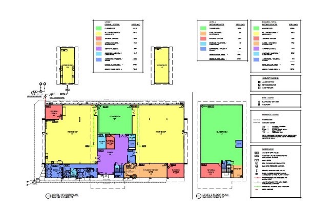
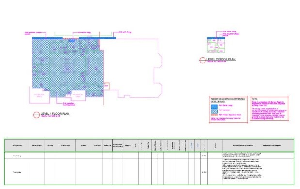
APG Architects have undertaken the creation of a full database of plans and details for the Te Wananga o Aotearoa Spatial Data system for all owned and leased properties.
Te Wananga o Aotearoa is the 3rd largest tertiary education provider in New Zealand with over 80 campuses in different towns and cities.
Plans were either drawn from good existing ‘As Built’ plans or created from site visits and actual taken measurements.
The plans were then updated with changes or as further detail was obtained, such as asbestos survey’s and reports or the addition of essential fire, security and electrical information. Plans were also subdivided into zones for area usage data for government survey requirements.
This data base, with a controlled layer protocol system, was provided to Te Wananga o Aotearoa as individual Autocad drawing files for their potential use and as individual PDF files (to enable flexible file use.)